
Product
Citybikes Vienna
Whether you live in Vienna or are visiting for a few days, Citybikes Vienna shows every WienMobil Rad station with live availability, the bike lanes around you and the nearest air pump when you need one. Find a bike, pick your route, and go.
Direct link
pertiller.tech/go/citybikes-vienna/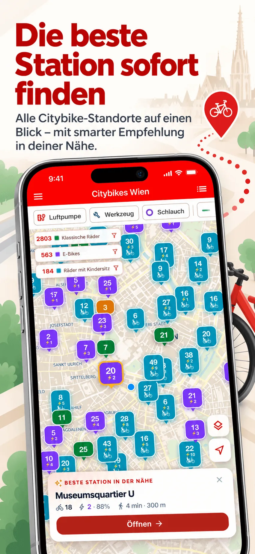
What the app does
Find the Right Bike
Tap classic bikes, e-bikes or bikes with a child seat right in the map legend to show only the stations that have them. Each e-bike shows its current battery level so you know how far it can take you.
Air Pumps and Bike Service
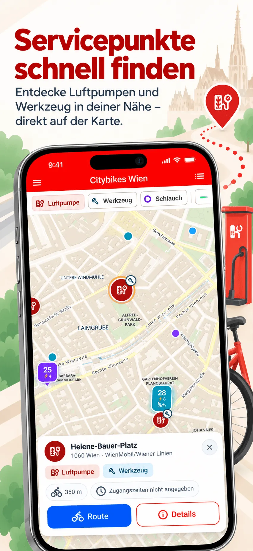
Flat tyre? The map shows more than 160 public air pumps, repair stations with tools and inner tube vending machines. Filter for what you need and start cycling directions to the nearest one with a single tap.
Bike Lanes on the Map
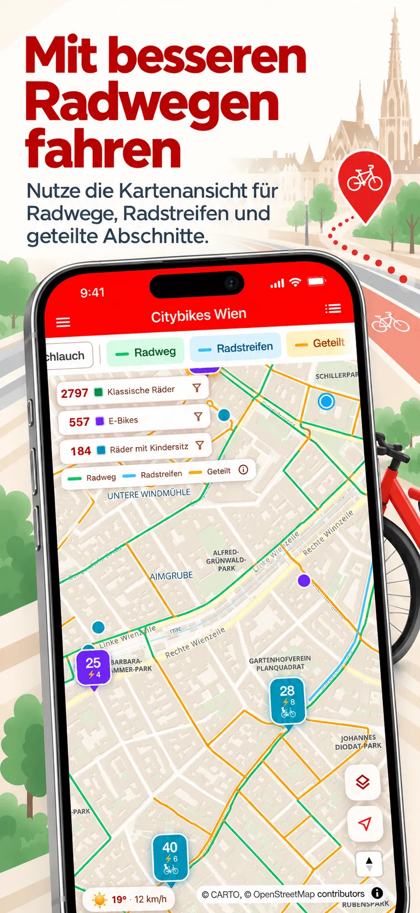
Show separated bike paths in green, painted lanes in blue and shared spaces in orange, and switch each type on or off. You can see what kind of road to expect before you set off.
Know Before You Go
Check typical availability for any hour of the day. If your regular station tends to be empty during the morning rush, the app tells you so you can plan ahead.
Never Miss a Bike
Tap the bell on any station to set a notification. The moment a bike becomes available there, you get an alert. Useful for peak hours when stations empty out fast.
Smart Suggestions
Not sure which station to head to? The app recommends the best option near you based on live availability and walking distance, and lists stations and service points by distance.
WienMobil Rad at a glance
How it works
Open the map
Every WienMobil Rad station appears on the map with live bike and box counts, colour-coded so you can see availability at a glance.
Tap any station
See exact bike counts, e-bike battery levels, free return spaces, typical availability and the walking distance from where you are.
Walk there and ride
Follow walking directions to the station. Pick up your bike and return it at another WienMobil Rad station when you finish your ride.
Common questions
From the blog
Built on Open Government Data
Radfahranlagen Wien
The bike lane layer uses the City of Vienna’s dataset of cycling facilities. It maps every separated bike path, painted lane and mixed-traffic section across the city. For anyone cycling in Vienna for the first time, knowing what kind of road to expect before setting off makes a real difference.
Dataset on data.gv.at ↗Luftpumpen und Radservice-Einrichtungen Standorte Wien
Air pumps, repair stations and inner tube vending machines come from the City of Vienna’s bike service dataset, maintained with the Mobilitätsagentur Wien. A copy ships with the app, so the locations still show when the data source is unreachable.
Dataset on data.gv.at ↗Data source: City of Vienna, data.wien.gv.at, licensed under CC BY 4.0, adapted for Citybikes Vienna. See Citybikes Vienna on data.gv.at ↗
This is an independent app, not affiliated with WienMobil, nextbike, or Wiener Linien.


Built by David Pertiller, a software architect and hands-on engineer in Vienna.