
Recently I was out on my bike in Vienna and needed an air pump.
I knew the city has public air pumps. The official city map even shows them. On a phone, though, they are extremely hard to find. The layer is tucked away, the map is built for a big screen, and the side of the road is not the place for a scavenger hunt.
So I did the obvious thing for someone who builds a Vienna cycling app: I put them into Citybikes Vienna.
The data was already there
The City of Vienna publishes its bike service locations as open data: the dataset Luftpumpen und Radservice-Einrichtungen Standorte Wien, maintained together with the Mobilitätsagentur Wien. It lists 166 locations: air pumps, self-service repair stations with tools, inner tube vending machines and even a bike wash. Each comes with an address, an operator and, for some, opening hours.
Everything a cyclist needs was available. It just was not where a cyclist looks.
One detail made a big difference
The dataset marks every location with a single icon. Filter for pumps and you get 20 results. That felt low, so I checked.
Most of the remaining locations are WienMobil service stations run by Wiener Linien. In the data they are marked as tool stations, but according to Wiener Linien every one of them also has an air pump. Counting those, and one pump that was simply tagged as a tool station, the real number is 106 places with an air pump. More than five times what a straight filter shows.
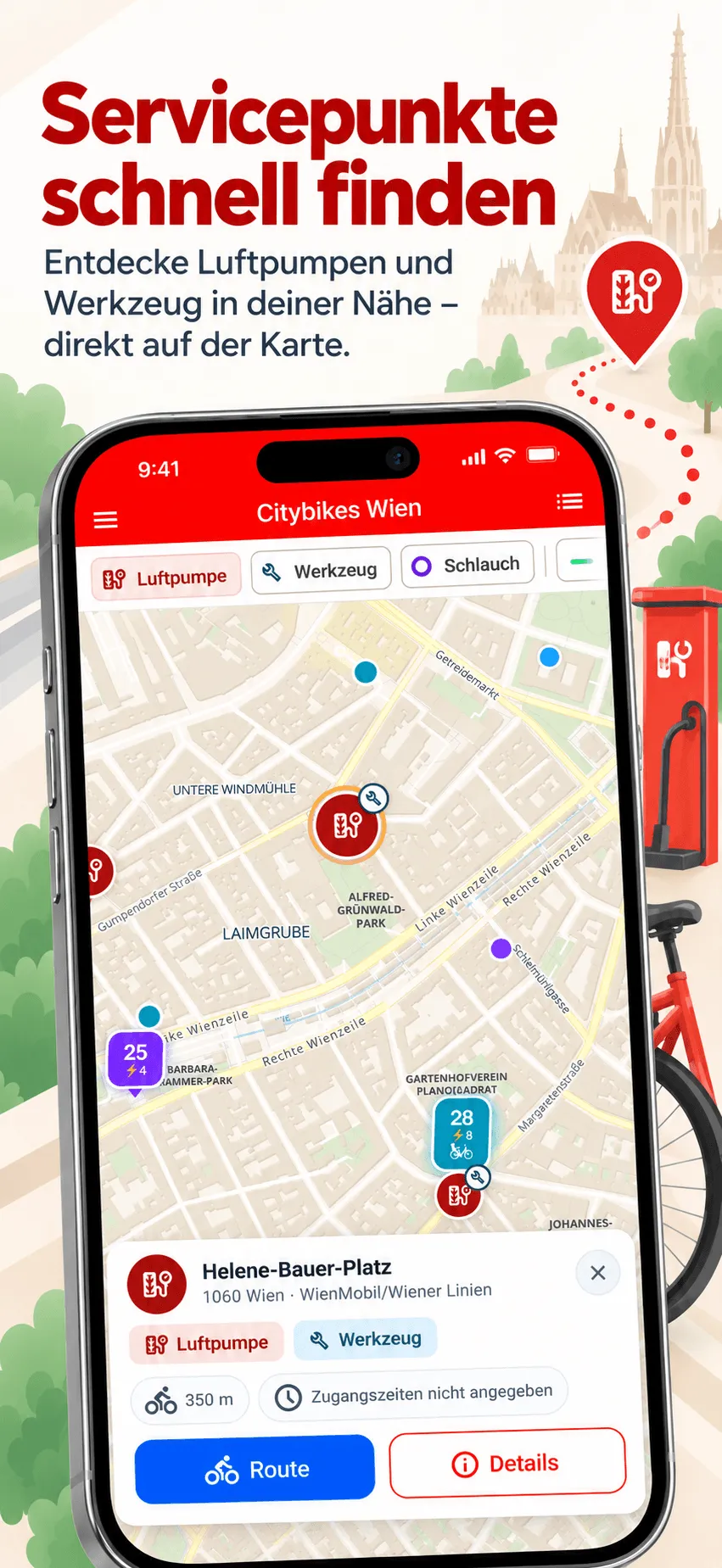
So the app treats equipment as features of a place instead of a single category. Filter for air pumps and you see all 106. Filter for tools and the same stations show up with a wrench, plus a small pump badge so you know there is more.
I have sent these findings to the City of Vienna’s open data team, so the dataset itself may get a separate equipment field one day.
What is new in version 9
- Air pumps, tools and inner tubes. Three chips at the top of the map switch them on. Tap a marker for the address, operator and opening hours, and start cycling directions with one tap.
- The nearest one comes to you. Turn on a filter and the map zooms to the closest match if none is in view.
- Works offline. A copy of the locations ships with the app and refreshes from the city’s data whenever you are online.
- Bike lanes you can control. Separated bike paths, painted lanes and shared spaces can now be switched on and off one by one, with a legend that explains each type.
- Filter by bike type from the map. The counts for classic bikes, e-bikes and child-seat bikes on the map are now buttons. Tap one to show only the stations that have them.
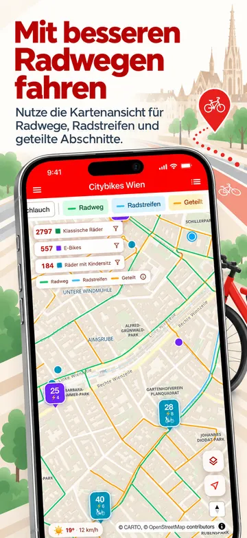
The bike lanes come from a second open dataset, Radfahranlagen Wien, which maps every cycling facility in the city. Both datasets are listed on the app’s entry on data.gv.at.
Why I like this kind of feature
Open data often sounds abstract. Here it is very concrete: someone at the city keeps a list of air pumps up to date, publishes it under an open licence, and it ends up helping you find air on the way home. My part was mostly putting it where people already look, on a map they already have open.
If you notice a pump that is broken or missing, you can report it to the Mobilitätsagentur Wien. That fixes it at the source, for every app and map that uses the data.
Get Citybikes Vienna
Citybikes Vienna is available on iOS and Android:


Air pump data: City of Vienna, data.wien.gv.at, licensed under CC BY 4.0, adapted for Citybikes Vienna. Citybikes Vienna is an independent app, not affiliated with WienMobil, nextbike or Wiener Linien.